 Flash News
Debutim i hidhur për Maran, Shqipëria mposhtet nga Izraeli
"We will bring the curly pelican to Surrel", tearful little girl's message to Rama from the protest
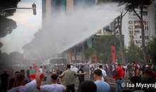
Video/ Police throw water on the crowd, protesters break the metal fence
Tragedy in Shëngjin, 2 young people from Kosovo lose their lives, 3 others end up in hospital
They went in to bathe, 4 young people are swept away by the waves at 'Rana e Hedhun', suspected victims
UN warns of 'Super El Niño' phenomenon: It could be among the strongest in history

Politiko
2026-06-03 15:20:32
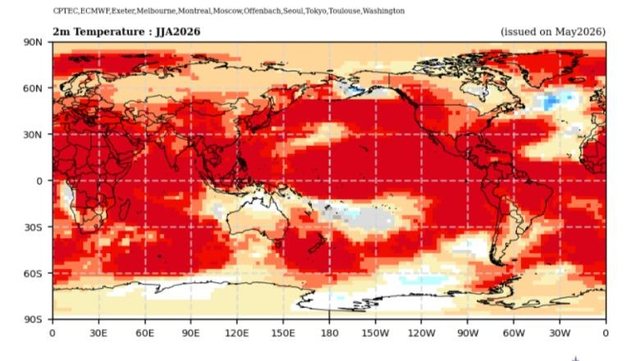
The United Nations has warned the world about the possibility of a natural meteorological phenomenon called a “Super El Niño,” which could be among the strongest ever recorded. The World Meteorological Organization (WMO) says the phenomenon, which increases global temperatures and intensifies rainfall, has an 80% chance of forming before September.
Although the phenomenon was expected, many scientists believe it could be extremely strong. It could even be a "record event", as Professor Adam Scaife, responsible for climate forecasts at the United Kingdom's Meteorological Service (Met Office), told the BBC.
UN Secretary-General António Guterres said the world should consider El Niño "as the urgent climate alarm that it represents."
Even if it doesn't reach the level of a "Super El Niño," the consequences could still be extreme, as the planet is already warmer due to climate change. Just think of 2024, when the El Niño that began in 2023 contributed to breaking global temperature records.
Climatologist Zeke Hausfather from the Berkeley Earth Group in the US explains to the BBC that, if the El Niño conditions of 1998 – then considered an exceptionally hot year – were repeated today, that year would appear relatively cool compared to the last two decades.
What is El Niño?
Explaining what this phenomenon is and why it also affects Italy, in April the scientific director of the Italian Climate Network, Serena Giacomin, described it to the newspaper Corriere della Sera in these words:
"El Niño disrupts global atmospheric circulation. It's a kind of giant thermodynamic machine and it's worrisome because it brings about a significant increase in temperatures," she said.
Essentially, El Niño is an anomaly in atmospheric and oceanic circulation associated with specific temperature changes in the tropical Pacific Ocean. Instead of warm waters moving towards Asia, they are pushed eastwards, towards the western coasts of the Americas. Precipitation follows the warm air masses, bringing wetter periods and increased flooding along the Gulf Coast and the southeastern United States.
The reason scientists are warning of a potentially record-breaking El Niño is because of data collected by satellites, buoys and floating ocean devices. These instruments have detected unusually warm water masses hundreds of meters deep, with temperatures in some areas more than 6 degrees Celsius above average, moving eastward across the Pacific Ocean.
According to experts, heat accumulated in the depths of the ocean is often a precursor to the warming of surface waters and, consequently, rising air temperatures.
“We can predict that 2027 will be a very hot year,” Giacomin explains. “A very warm atmosphere means a lot of energy in the climate system and, consequently, much more extreme weather.”
Although scientists cannot determine with certainty what will happen and how long the phenomenon will last, the experience of past years shows that when El Niño has appeared, southern Europe has recorded a more extreme climate, with what experts call "climate shocks". This includes long periods of drought and water shortages, followed by particularly intense rainfall and strong atmospheric phenomena./CorrieredellaSera
Latest news


Tension in "Air Albania" after Israel's goal, Hysaj clashes with Gloukh
2026-06-03 22:21:33
Debutim i hidhur për Maran, Shqipëria mposhtet nga Izraeli
2026-06-03 22:01:35
Këlliçi: Rama është sot një Kryeministër i ezauruar totalisht
2026-06-03 21:38:01
Costa porosit liderët: BE-ja s’mund të bëjë detyrat e shtëpisë të Kosovës
2026-06-03 21:16:35
6 në 10 persona përdorin AI për shëndetin mendor
2026-06-03 20:56:11
Tifozët kuqezinj fërshëllejnë himnin izraelit
2026-06-03 20:34:01
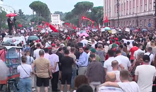
"Resign, we want revolution", citizens chant outside Rama's office
2026-06-03 19:58:32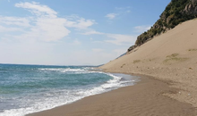
The two young men who lost their lives in Shëngjin are identified
2026-06-03 19:43:35
Official lineups for the Albania-Israel friendly are published
2026-06-03 19:18:56
Video/ Police throw water on the crowd, protesters break the metal fence
2026-06-03 18:59:00
The best professions for free time and less stress
2026-06-03 18:48:43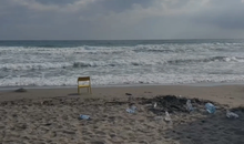

The Federation of North Macedonia excludes Shkëndija Tetovo from the Cup
2026-06-03 18:16:04
Blow for Broja, his value on "Transfermarkt" drops to 5 million euros
2026-06-03 17:53:09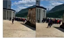
Bulqiza miners in protest, miners demand improved working conditions
2026-06-03 17:29:39


Trump admits clash with Netanyahu: I asked him to stop the escalation in Lebanon
2026-06-03 16:30:32
By 2030, 45% of women are expected to be single and childless
2026-06-03 16:19:53


Alarm for the Rossoneri! Uzun risks the challenge against Israel
2026-06-03 15:52:21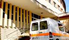
Two people were injured by a bomb explosion in Përmet, police provide details
2026-06-03 15:35:24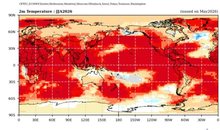
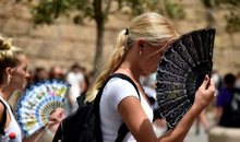
The heat wave does not spare Spain, 101 people lost their lives in May alone
2026-06-03 15:09:35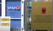
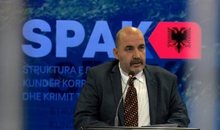
Hearing for the defendants in the Veliaj case, SPAK gives its claim
2026-06-03 14:56:31

Murder of Martin Can, Appeal decision for Mario Përlleshaj postponed
2026-06-03 14:18:24
Can hackers steal fingerprints from photos on social media?
2026-06-03 14:02:14

Explosion in Përmet, two people seriously injured, one urgently sent to Tirana
2026-06-03 13:41:21

Berlin signals opening of Europe-Russia talks on Ukraine
2026-06-03 13:27:09
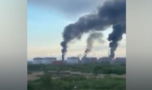
Explosions at oil terminal, footage from the attack in St. Petersburg
2026-06-03 13:01:14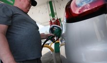
CNN: US-Iran ceasefire is straining, oil prices rise again
2026-06-03 12:42:57


Albania becomes the second most expensive in the Balkans for daily rentals
2026-06-03 12:13:35


Berisha on the trial against Meta: Political farce ordered by Rama
2026-06-03 11:36:15
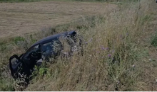
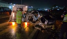
Accident in Levan-Tepelena, car ends up in canal
2026-06-03 11:16:34


Antonio Costa in Kosovo today, meets Haxhiu, Kurti and party leaders
2026-06-03 10:18:56
'1 million lek to put a cell phone in prison', Beci: 'Flash' checks to seize it
2026-06-03 10:06:29

Horoscope June 3, 2026, discover the star predictions
2026-06-03 09:51:56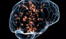
Traumat në fëmijëri lënë gjurmë në tru
2026-06-03 09:34:20
Bank robbery in Tirana, guard arrested: He did not act to neutralize the robber
2026-06-03 09:23:25


Foreign exchange/ How much foreign currencies are bought and sold today
2026-06-03 08:25:50
Long note for those who can't read
2026-06-03 08:03:50

33 degrees Celsius in some areas, as the weather forecast is for today
2026-06-03 07:25:07
Morning Post/ In 2 lines: What mattered yesterday in Albania
2026-06-03 07:01:04
American professor: US priority for Albania remains security and the rule of law
2026-06-02 23:01:00


Appeal removes Ergys Agas' apartment from seizure
2026-06-02 20:39:08


Negotiations could unblock Ukraine's bid for EU membership
2026-06-02 18:55:18


Why does the government only invest offshore money in Albania?
2026-06-02 17:11:26

"We will cancel every flight," Brussels airport is suddenly blocked
2026-06-02 16:30:11


Germany worried about poverty, the elderly are the most affected!
2026-06-02 15:16:09

Pentagon restricts media access to press office
2026-06-02 14:48:08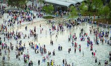

6 ways social media can reveal a narcissist
2026-06-02 14:30:44
Italy, Albanian truck driver loses his life at the port of Ancona
2026-06-02 14:22:10

Bank robbery in Tirana, masked perpetrator stole 10-15 thousand pounds
2026-06-02 14:03:33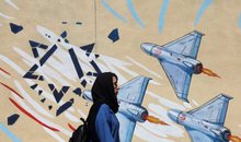
US: Agreement with Iran expected to be reached next week
2026-06-02 13:50:57
Accident in Patoku Valley, motorcycle driver seriously injured
2026-06-02 13:39:19
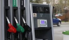
The Transparency Board "seals" the new oil and gasoline prices
2026-06-02 13:17:38

Armed robbery at a second-tier bank in Tirana
2026-06-02 13:05:59