 Flash News
International drug search: 36-year-old arrested in Durrës (NAME)
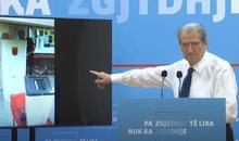
Veliaj's appeal to be heard today in the High Court
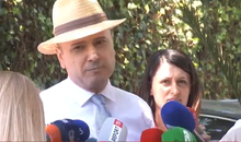
Today's hearing at the Fier Court, Salianji requests conditional release
Taxi collides with truck on Lezhë-Shkodër axis, driver taken to Trauma in serious condition
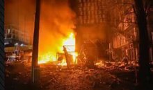
At least 91 dead in Texas floods
Rain, storms and lower temperatures, what will the temperatures be like today and during the week

Politiko
2024-04-15 08:17:55

This week our country will be affected by unstable atmospheric conditions as a result of the gradual withdrawal of the African anticyclonic circulation with warm and dry air masses and the penetration of moist and cold northern air masses.
In most of the days, the pressure will be low and the temperature fluctuations will be pronounced, especially the drops in the maximum values.
On Monday, the weather will be clear and high and transparent clouds will pass.
On Tuesday, the weather will initially be clear, while after noon we have a total change in the meteorological situation, where we have a gradual development of clouds. The clouds will be medium to dense accompanied by low to medium intensity rain in the form of thunderstorms.
Rainfall will also be present during Wednesday, Thursday and Friday in the form of rapid downpours and storms with electrical discharges and hail which in short time intervals in the northwest of the country and in urban areas mainly during the day problems appear on Wednesday. However, there will be occasional sunny intervals.
Snowfall will return to the Alps and the mountain reliefs in the north-northeast-southeast of the country with low and locally average intensity at heights above 700m.
During Wednesday, the wind will be intense from time to time in the northwest-southwest direction 2-9m/s, while in the mountains, valleys and along the coastline it will reach a speed of 12-18m/s, accompanied by waves in the Adriatic and Ionian seas of strength 4-5 faces.
The presence of fog and mist in the early hours of the morning as well as at the time of rain and snow is emphasized.
Latest news
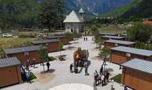
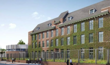
Thethi, tourists "criticize" modern trend
2025-07-08 09:39:54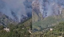
Fire on Mount Dukat still active, Llogara National Park at risk
2025-07-08 09:28:12
Veliaj's appeal to be heard today in the High Court
2025-07-08 09:16:02
"Bad sign for democracy"/ Parliament neglects reporting by institutions
2025-07-08 09:04:56
Today's hearing at the Fier Court, Salianji requests conditional release
2025-07-08 08:56:39


Horoscope, what do the stars have in store for you today?
2025-07-08 08:16:19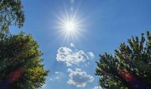
Weather forecast/ How temperatures will vary throughout the day
2025-07-08 08:02:37
Morning Post/ In 2 lines: What mattered yesterday in Albania
2025-07-08 07:48:30


Marrëdhënia që s’është romancë, por s’është as thjesht kolegiale
2025-07-07 21:39:13
Citizen is asked to pay 2.5 million for a non-existent meter
2025-07-07 21:28:03


What is the ideal air conditioner temperature in summer?
2025-07-07 20:53:46
GJKKO left him in prison, Meta appeals the decision
2025-07-07 20:38:05
Where is Ronaldo after missing Diogo Jota's funeral?
2025-07-07 20:38:04

Messages from the author who killed Ilaria Sulla in Rome are revealed
2025-07-07 20:20:12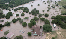
At least 91 dead in Texas floods
2025-07-07 20:12:02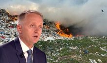
Elbasan, choked by smoke, scorched by conscience
2025-07-07 19:48:16
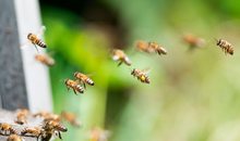
Swarm of bees attacks citizens in France, 24 people end up in hospital
2025-07-07 19:32:03
Dementia/Hearing loss may be a warning sign
2025-07-07 19:13:06
The decision for Malltez, Gjokutaj: Boomerang for SPAK and the Court
2025-07-07 19:01:08
Former Supreme Court member acquitted of asset concealment
2025-07-07 18:36:40
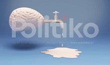
WIIW expert in Politiko: Brain drain is steadily weakening the Albanian economy
2025-07-07 18:11:41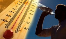
Heart health is at risk from extreme heat, here's what you should be careful of
2025-07-07 18:10:18
Today Gert Bogdani would celebrate, Edlira Çepani's touching dedication
2025-07-07 17:40:45


The striker severely accuses the Fenerbahce club: They tried to drug me
2025-07-07 16:21:03
A decomposed body is found in Kolonjë, initial suspicions
2025-07-07 16:03:31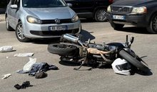
Accident in Saranda, car hits motorcycle, one injured
2025-07-07 15:58:56
The most fertile age for men and women
2025-07-07 15:40:52
Locals, Rama candidate in 5 municipalities
2025-07-07 15:32:22
Blushi: Meta's criminal kidnapping, incomparable even to Navalny's in Russia
2025-07-07 15:20:34
Meet the iPhone 17 Pro, the main innovations in design and technology
2025-07-07 15:09:09
Why the release of Abi Malltez does not free him; much less Albania
2025-07-07 15:00:12
‘Lidhjet klienteliste’ të mjekëve mbushin recetat e pacientëve
2025-07-07 14:57:33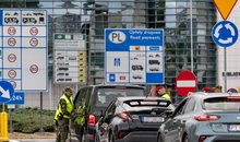
Poland imposes border controls with Germany and Lithuania
2025-07-07 14:48:15

Caught transporting firearms from Kosovo to Albania, young man arrested (NAME)
2025-07-07 14:37:47
Theo Hernandez flies to Saudi Arabia for medical check-ups
2025-07-07 14:26:47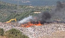

Scorching heat, Greece orders mandatory work holidays
2025-07-07 13:54:25


Trump expects Netanyahu to discuss Gaza ceasefire
2025-07-07 12:54:27
GJKKO releases Jamarbër Malltezi from house arrest
2025-07-07 12:35:02
Tourism among contrasts
2025-07-07 12:31:01
IKMT action in Theth, starts demolition of unauthorized constructions
2025-07-07 12:24:18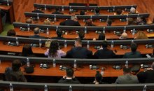
The Tirana-Kamëz line is destroyed by urban fire
2025-07-07 12:00:24


Poor direction!
2025-07-07 11:16:01


Rama to gather the country's mayors on July 9
2025-07-07 10:43:31
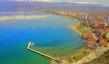
Ohrid Natural Park on the way to UNESCO's "black list"
2025-07-07 10:25:58

Registrations for the new school year begin in e-Albania
2025-07-07 09:59:09
KAS decides the "fate" of the elections in four districts of the country today
2025-07-07 09:50:51
Rama does not give up on Vlora, visits the municipality again
2025-07-07 09:39:11
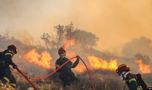
Fires in Gjirokastra, flames very close to cultural monuments
2025-07-07 09:12:49
Foreign exchange, the rate at which foreign currencies are sold and bought
2025-07-07 08:39:57

Horoscope, what do the stars have in store for you today?
2025-07-07 08:14:17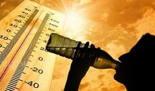
The week starts with scorching temperatures, the thermometer reaches 37°C
2025-07-07 07:58:36
Morning Post/ In 2 lines: What mattered yesterday in Albania
2025-07-07 07:45:15